Mizoram is a landlocked state in northeastern India, with Aizawl as its capital and largest city. It shares 722-kilometres (449 miles) of international borders with Bangladesh to the west, and Myanmar to the east and south, with domestic borders with the Indian states of Assam, Manipur, and Tripura.[5] It covers an area of 21,087 square kilometres[6] (8,139 sq mi) which 91% of the area is covered by forests, making it the most heavily forested state in India.[7] With an estimated population of 1.25 million in 2023, it is the second least populated state in India.[8] With an urbanisation rate of 51.5% it is the most urbanised state in northeast India, ranking fifth in urbanisation nationwide.[9] One of the two official languages and most widely spoken tongue is Mizo[b], which serves as a lingua franca among various ethnic communities who speak a variety of other Tibeto-Burman or Indo-Aryan languages. Mizoram is home to the highest percentage of scheduled tribes in India, with the Mizo people forming the majority.
Early civilisations in Mizoram are believed to have thrived since around 600 BC, with significant archaeological evidence uncovered in the Vangchhia region.[11][12][13] Following this, Tibeto-Burman-speaking peoples gradually migrated from the Chin Hills in present-day Myanmar. [14] These groups formed organised chiefdoms and adopted jhum agricultural practices. By the 18th century, various clans in the region united to form the Mizo identity, becoming the dominant inhabitants of the area, introducing the Mizo language, culture, and the Sakhua religion.[15] In the mid-19th century, the British conducted a series of military expeditions to assert control over the region, Mizoram was annexed by the British in 1895 and incorporated into the Assam Province.[16][17] Under British rule, the introduction of administrative reforms and the spread of Christianity significantly impacted Mizo society.
After India gained independence in 1947, Mizoram remained part of Assam as the Lushai Hills District. After the Assamese Government's negligence of the Mizos during the famine, insurgency was led by the Mizo National Front in the 1960s which culminated in the signing of the Mizoram Peace Accord in 1986.[19] On 20 February 1987, Mizoram was granted full statehood, becoming the 23rd state of India.
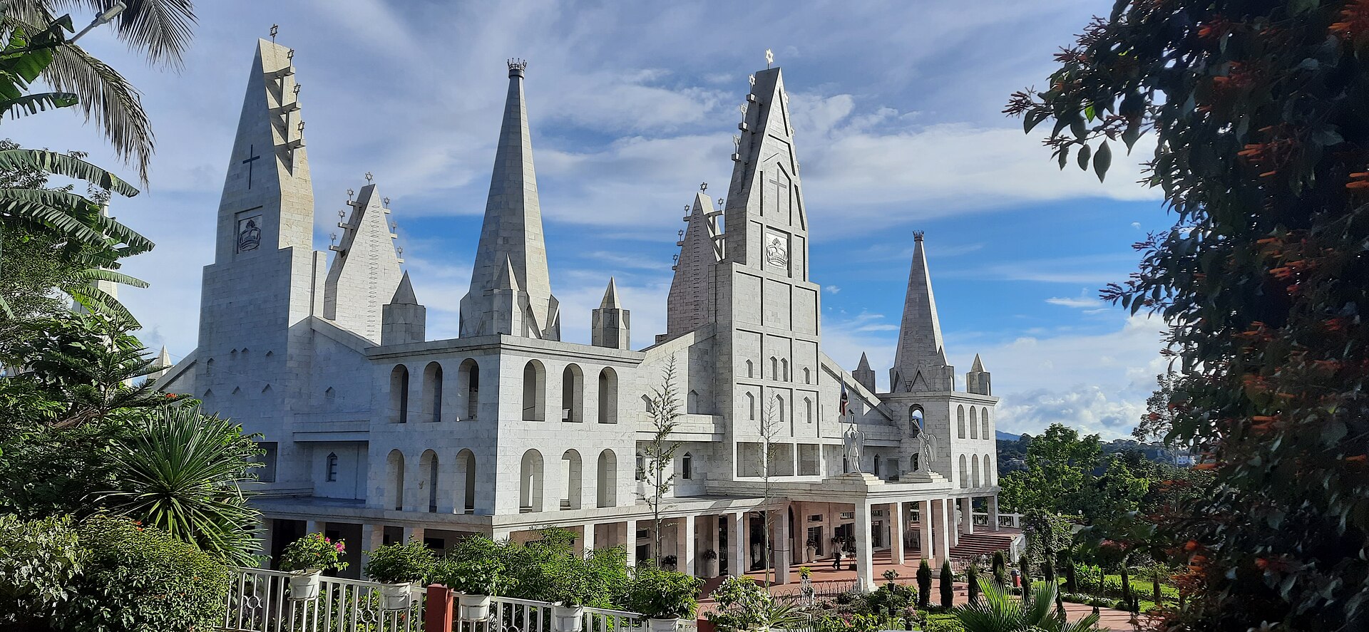
Mizoram is predominantly Christian, with about 87% of the population practising Christianity, mainly Protestant denominations such as Presbyterian and Baptist. It is one of the three states of India with a Christian majority (87%). Other religions such as Buddhism (8.51%), Hinduism (2.75%), and Islam (1.35%) are also practised in the state.[21] Mizoram's population is predominantly made up of Mizo or Zo tribes, comprising about 83.4% of the state's population, with other significant communities including the Chakma (8.5%) and Tripuri (3%). Due to the prolonged civil conflict in Myanmar, Mizoram has also seen an influx of Burmese communities, especially from the Chin ethnic group, which have sought refuge in the region, with an estimated 70,000 to 100,000 Burmese refugees residing in the state.
Mizoram is a highly literate agrarian economy. Slash-and-burn farming, also known as jhum, is the most common form of farming in the state.[23] In recent years, the jhum farming practices have been steadily replaced with a significant horticulture and bamboo products industry.[24][25] The state's gross state domestic product for 2012 was estimated at ₹69.91 billion (US$820 million).[6] About 20% of Mizoram's population lives below the poverty line, with 35% rural poverty as of 2014.[26] The state has about 871 kilometres of national highways, with NH–54 and NH–150 connecting it to Assam and Manipur respectively. It is also a growing transit point for trade with Myanmar and Bangladesh.
Capital: Aizawl
Area: 21,081 km2 (8,139 sq mi)
Population: 1,252,000 (2011)
Official Languages: Mizo, English
Average Elevation: 304.8 m (1,000 ft)
A map is loading
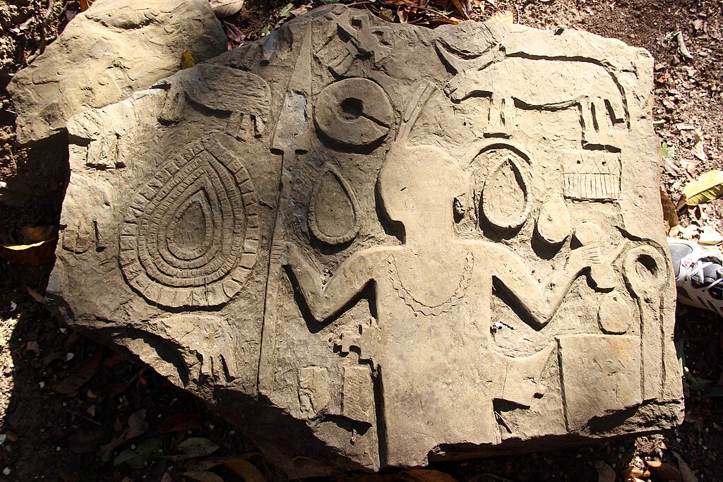
Kawtchhuah Ropui literally means ‘the great entrance of the village’. In most tribal societies of this region, a cluster of memorial stones were traditionally erected in the entrance of settlements in commemoration to their dear ones, braves or outstanding persons who won victories in war or hunting untamed animals. However, the uniqueness of Kawtchhuah Ropui has been seen that all the figures were embossed. It may be assumed that the dressing of Kawtchhuah Ropui stones might be done with fine iron-tools. From this point of view, I strongly opined that the past Mizo people were impossible to erect all these well-dressed stones due to lack of iron tools among the Mizos till the Bristish colonial power. Succession of the Past Settlements: Findings of potsherds near Kawtchhuah Ropui showed that there were two successions of settlement in this area. The typology of dressing clay-pots confirms this hypothesis. There have been found two types of potsherds, greatly differed from each other in its dressing – the first had irrigular threads of dress-finishing and well-baked while the second one bore regular threads ressembling the Mizo traditional techniuqes of dressing clay-pots. These striking features help us confident to conclude that two successions of human settlement must confine to this place, mizoram, India
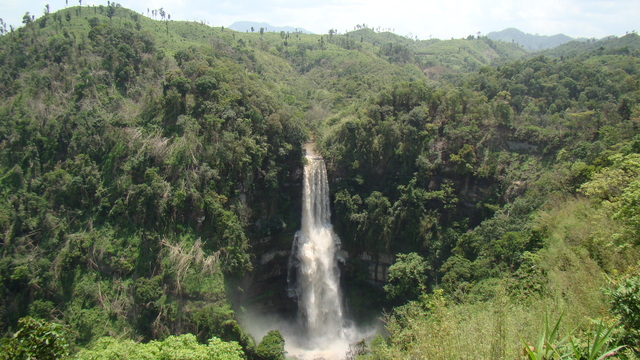
Vantawng waterfall, mizoram, India
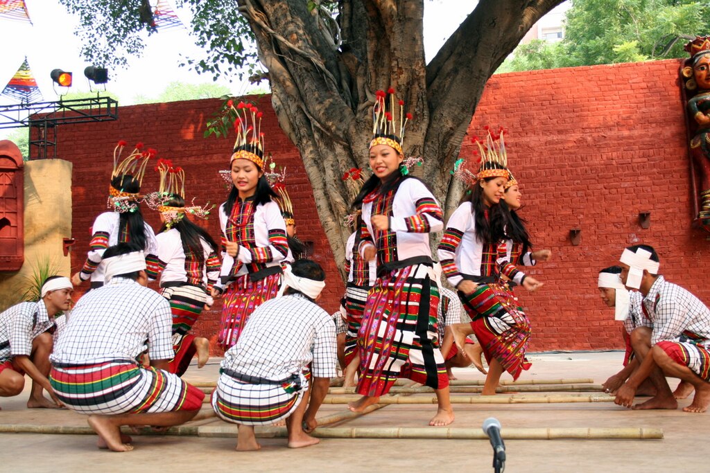
This is one of the most popular folk dances of Mizoram. The Mizos brought it with them from their early abode in the Far East. It is a community dance also commonly known as the bamboo dance, though actually it has no connection with the bamboo. In earlier days, the dancers usually danced over decorated wooden sticks. There is no particular occasion for performing Cheraw; it is for entertainment and merry-making. Group of Institute of Music and Fine Arts, Aizawl is performing the Cheraw dance, mizoram, india
Phawngpui National Park, mizoram, india
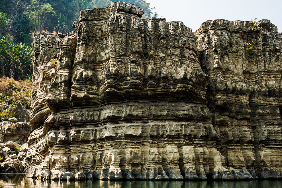
Rock formation known as Kolodyne Castle, mizoram, India