Himachal Pradesh is a state in the northern part of India. Situated in the Western Himalayas, it is one of the thirteen mountain states and is characterised by an extreme landscape featuring several peaks and extensive river systems. Himachal Pradesh is the northernmost state of India and shares borders with the union territories of Jammu and Kashmir and Ladakh to the north, and the states of Punjab to the west, Haryana to the southwest, Uttarakhand to the southeast and a very narrow border with Uttar Pradesh to the south. The state also shares an international border to the east with the Tibet Autonomous Region in China. Himachal Pradesh is also known as Dev Bhoomi, meaning 'Land of Gods'[10] and Veer Bhoomi which means 'Land of the Brave'.
The predominantly mountainous region comprising the present-day Himachal Pradesh has been inhabited since pre-historic times, having witnessed multiple waves of human migrations from other areas.[12] Through its history, the region was mostly ruled by local kingdoms, some of which accepted the suzerainty of larger empires. Prior to India's independence from the British, Himachal comprised the hilly regions of the Punjab Province of British India. After independence, many of the hilly territories were organised as the Chief Commissioner's province of Himachal Pradesh, which later became a Union Territory. In 1966, hilly areas of the neighbouring Punjab state were merged into Himachal and it was ultimately granted full statehood in 1971.
Himachal Pradesh is spread across valleys with many perennial rivers flowing through them. Agriculture, horticulture, hydropower, and tourism are important constituents of the state's economy. The hilly state is almost universally electrified, with 99.5% of households having electricity as of 2016. The state was declared India's second open-defecation-free state in 2016.[13] According to a survey of CMS-India Corruption Study in 2017, Himachal Pradesh is India's least corrupt state.
Himachal Pradesh is divided into 12 districts.
Capital: Shimla & Dharamshala (winter)
Area: 55,673 km2 (21,495 sq mi)
Population: 6,864,602 (2011)
Official Languages: Hindi, Sanskrit
Average Elevation: 350 m (1,150 ft)
Lowest Elevation: 232 m (761 ft) ()
Highest Elevation: 6,813 m (22,352 ft) (Reo Purgyil)
A map is loading
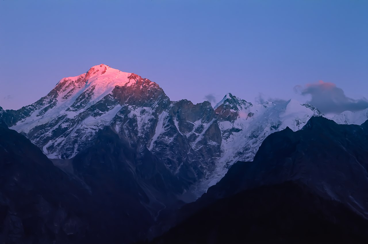
Mount Kinnaur Kailash, himachal pradesh, india
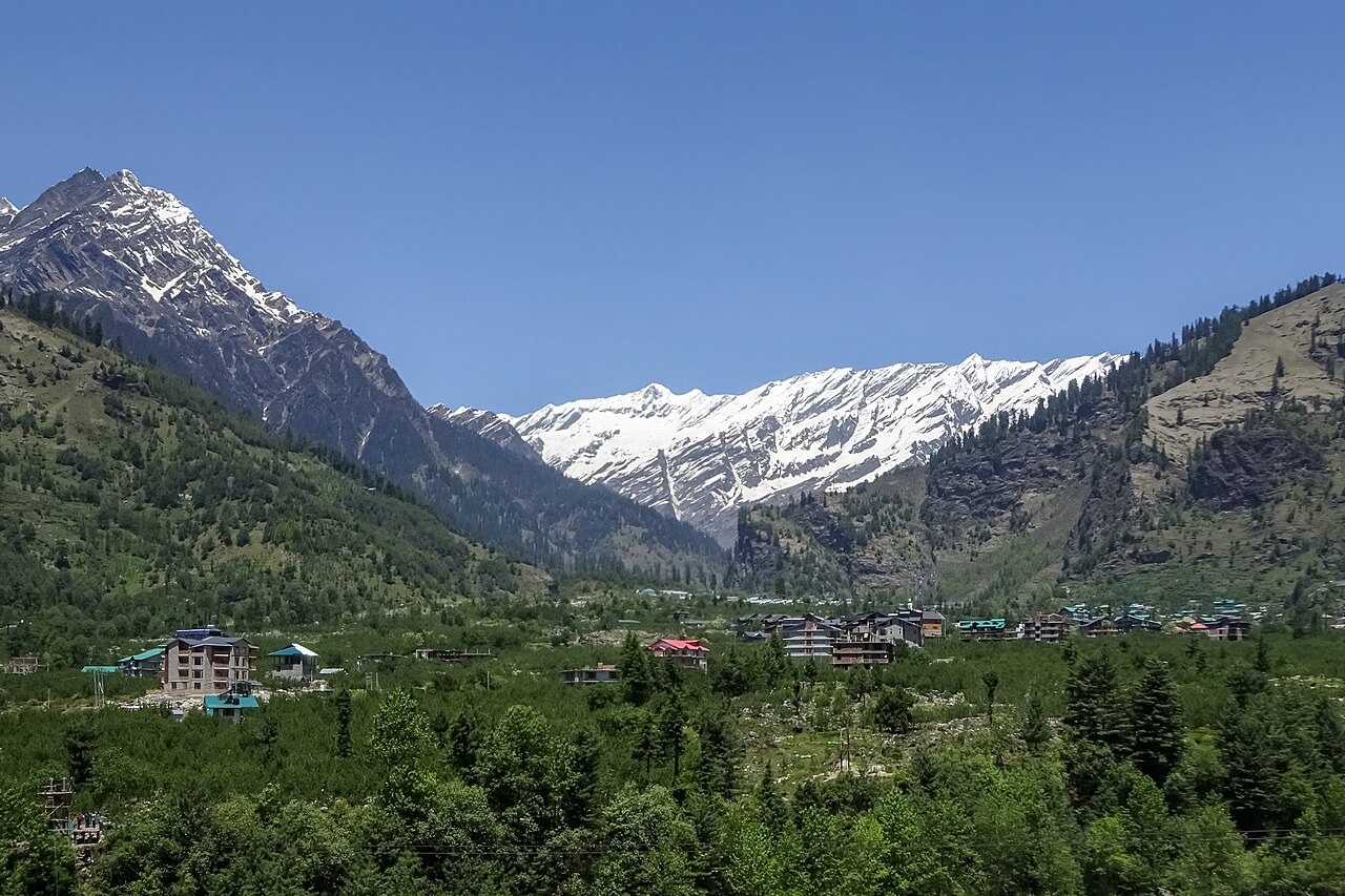
the Kullu Valley north of the resort town of Manali in the northern Indian state of Himachal Pradesh, India. Several peaks of the Middle Himalayan Pir Panjal range are visible.
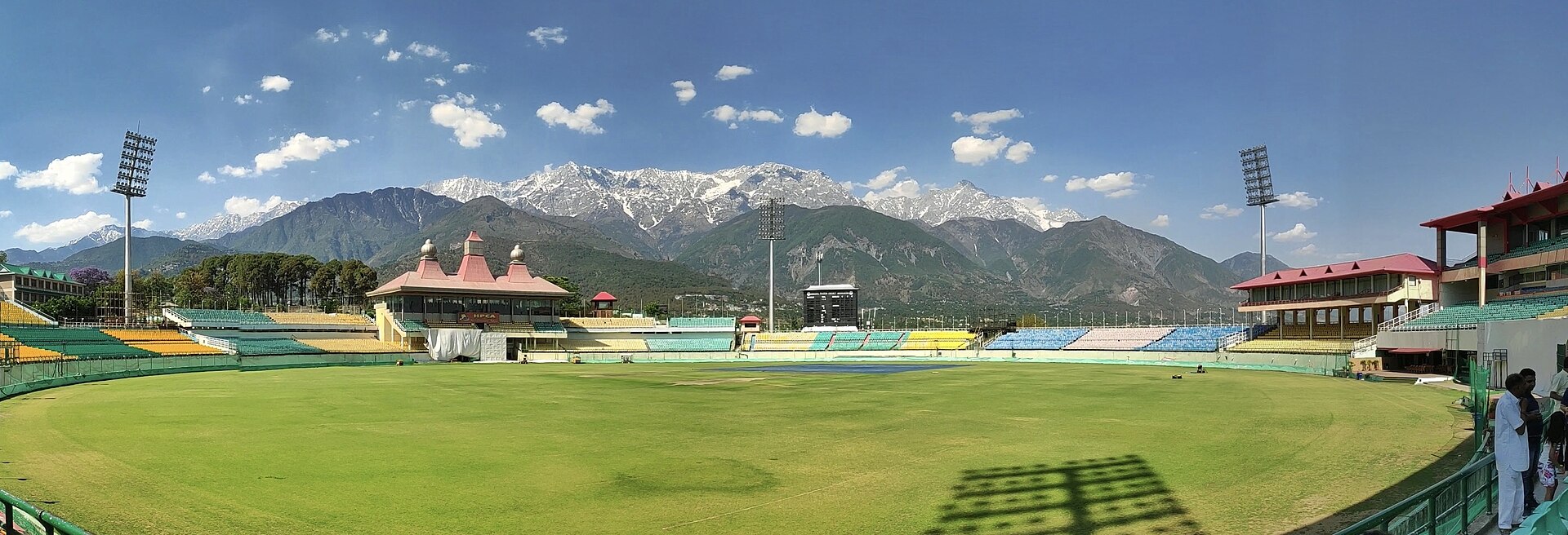
Dhauladhar Range as seen from the HPCA Stadium, Dharamshala, Himachal Pradesh, India.
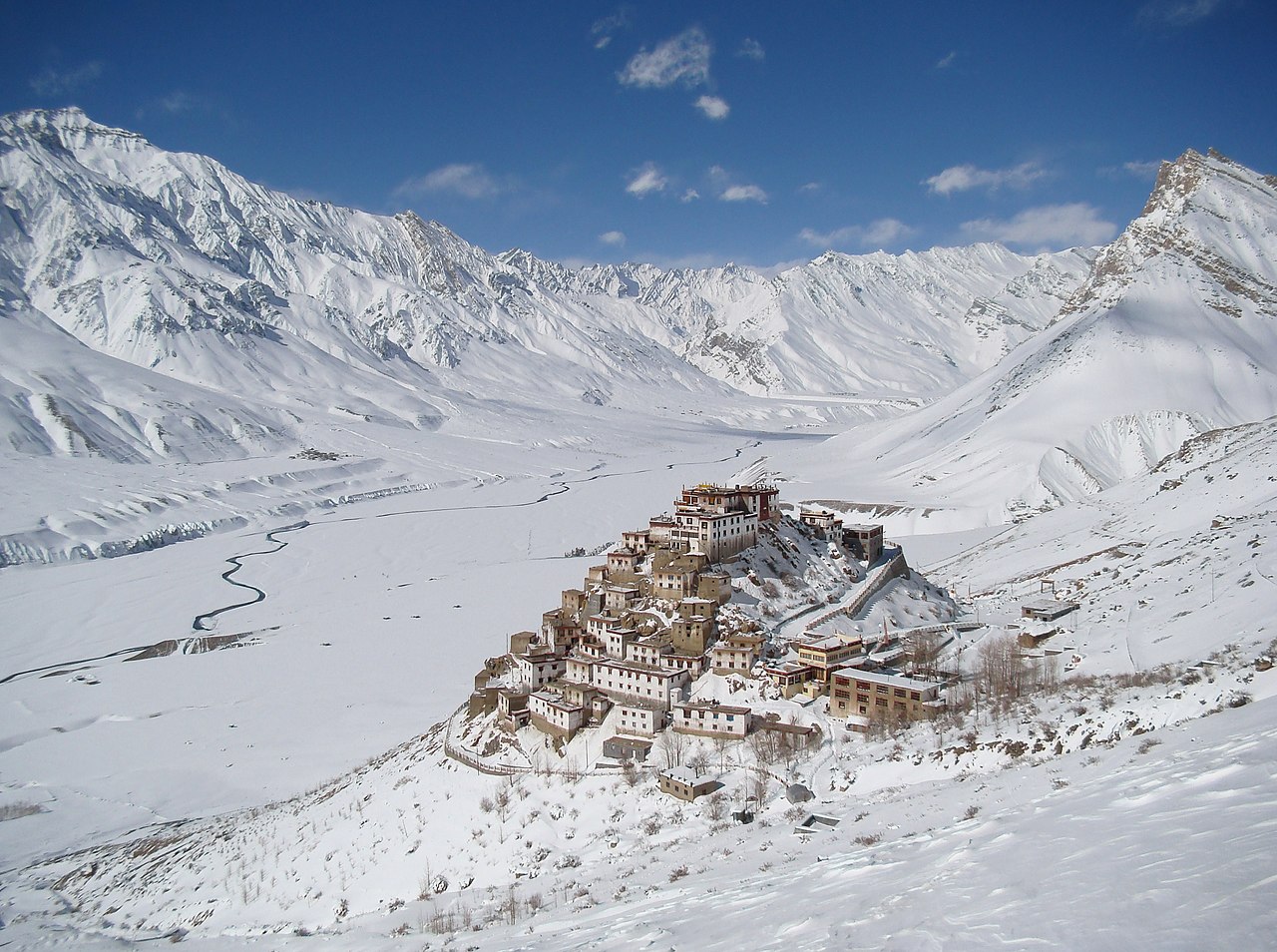
Key Monastery is a monastery belonging to the Gelugpa school of Tibetan Buddhism, located at an elevation of 4,166 metres (13,668 ft) on a hill rising above the Spiti Valley in the northern Indian state of Himachal Pradesh. Claimed to have been founded in the 11th century, the monastery is the largest in Spiti and is home to a couple of hundred monks. Pictured here in winter, with the Himalayas in the background and the Spiti river flowing through the snow-covered valley below it.
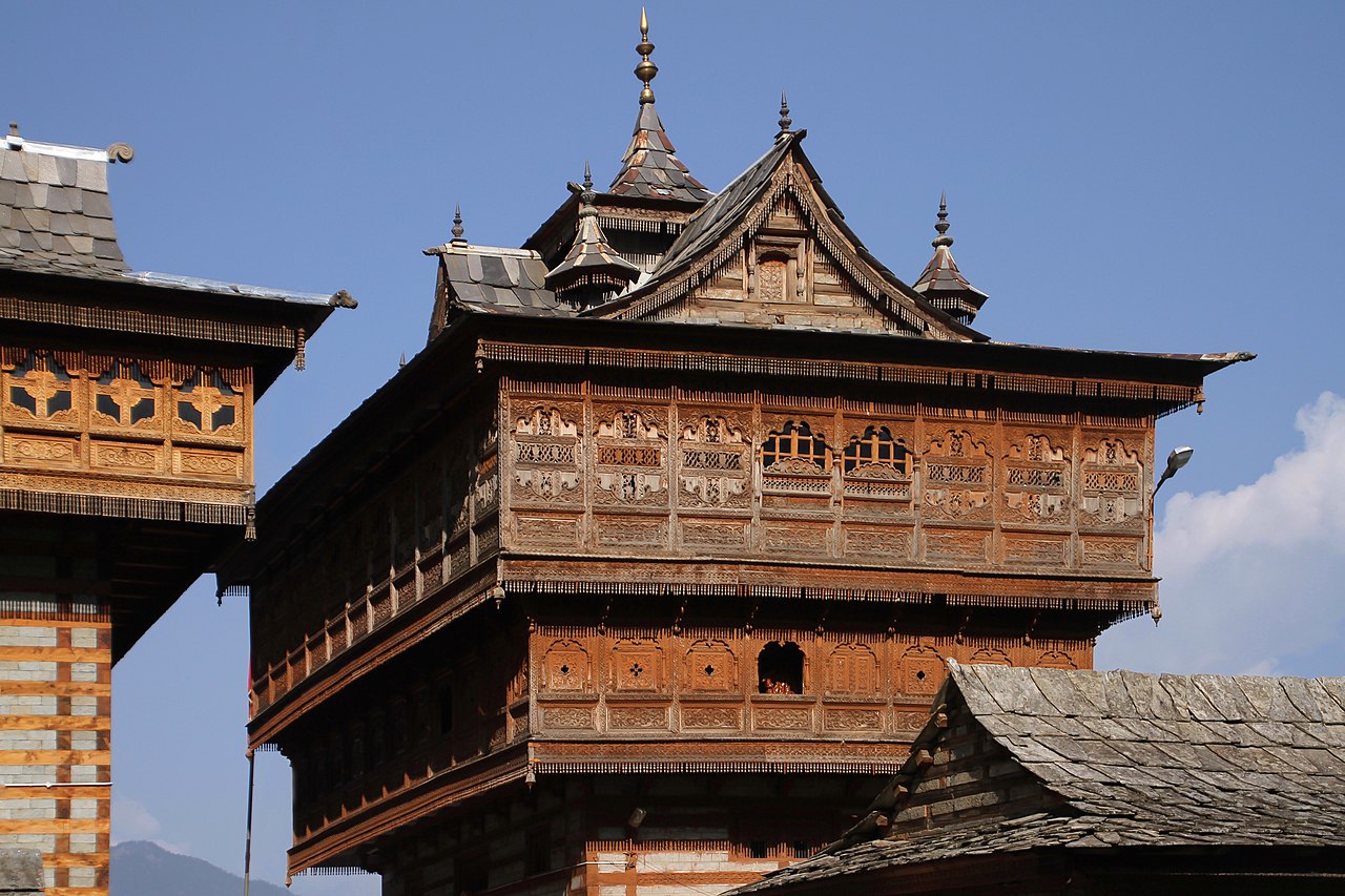
Sarahan Bhimakali temple in Himachal Pradesh in India.
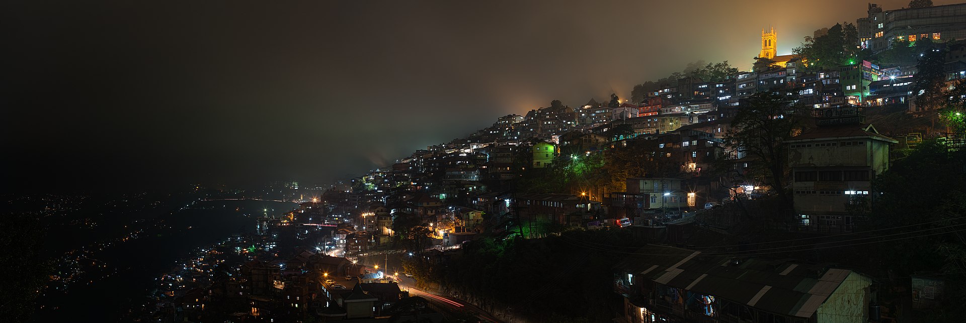
Shimla at night, Himachal Pradesh, India